Thursday, August 31, 2006

Flower Safari and Into Namibia

It has been a while, and sorry to say this may be the frequency of blog entries from here on out. Namibia is a barren place. Towns are hard to find sometimes let alone internet cafes! I'll do my best to fill you in since the last entry.

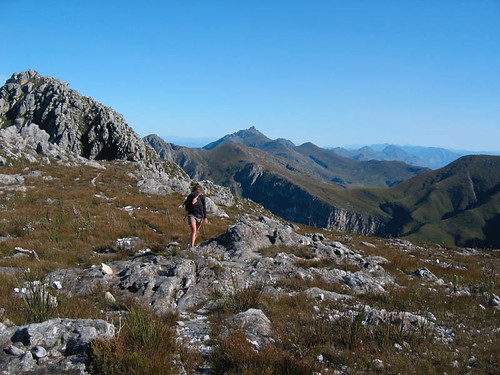
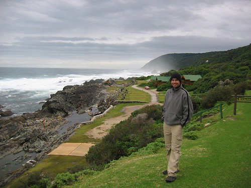
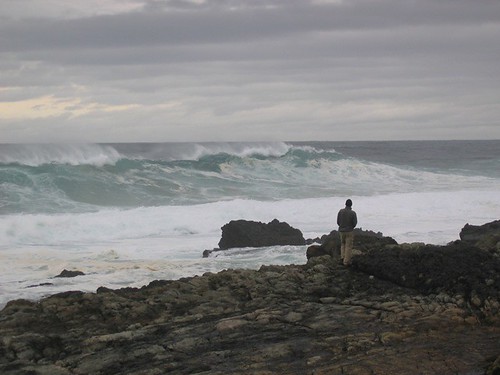
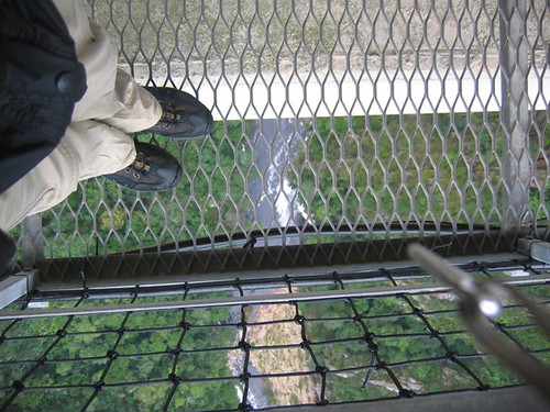
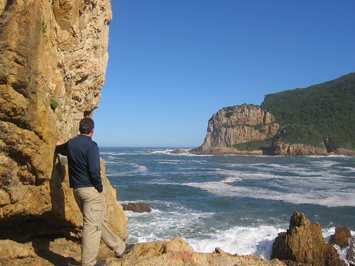
From Cape Town we headed north to the wine country of Stellenbosch. We are not nearly refined enough to appreciate it fully, and Keith is not big on wine anymore (thanks to the Newport Wine Festival!), so we put in a rather short appearance. We did walk away with a couple bottles of vino and saw some beautiful countryside and estates.

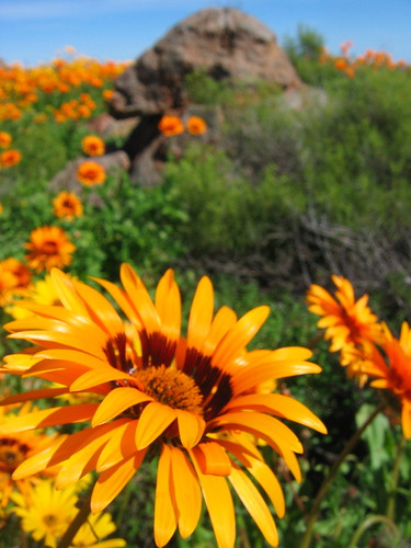
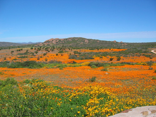
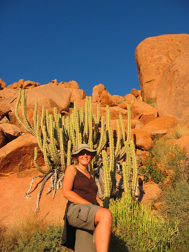
From there we pushed north up the N7 in search of the famous flower bloom of Namaqualand. The area 200-300 km north of Cape Town is an arid, dry place that springs to life with wildflowers after the first rains of the year. As the brochures and guidebooks say, the ground is carpeted in color. The flowers don't last long and the timing of their arrival obviously varies from year to year depending on the weather. We had heard it was worth seeing so we had sort of planned our movement through South Africa around it, hoping Mother Nature would work with our schedule. We did some asking around as we neared CapeTown and learned the flowers were early this year and that they were having one of the best years ever. Now we were worried we would be late, but it all turned out beautifully.

Our first night in flower country we stayed in Clanwilliam and walked around a semi-groomed wildflower garden. The next day, we headed further north towards Springbok and on that stretch of road is where the real show started. Just driving along the highway, you are treated to wonderful displays of color - mostly orange and purple. We stayed that night in a small town called Kamieskroon which is the closest town to the Namaqualand National Park where some of the most dramatic displays are seen. So we spent that afternoon and the next morning strolling around the never-ending fields of orange.

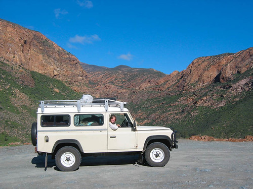
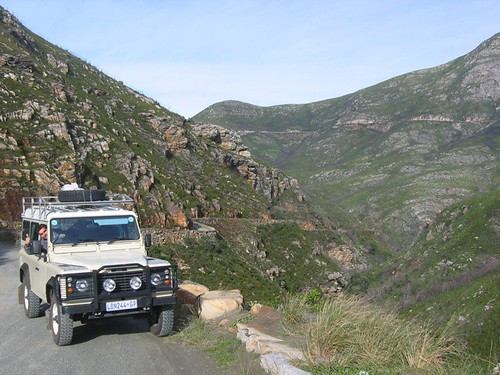
To get to Springbok, we took a back road/dirt road out of the park and were treated to even more spectacular views. We also got to really use the Land Rover for what it is intended and helped a stranded family get their 'bakkie' across a river bed. We camped in Springbok that night and woke to....guess what? Rain! A very light, misty rain, but good thing we saw the flowers when we did as those little guys weren't going to be opening up on such a grey day. Here are just two of the at least 100 photos we took of flowers. We enjoyed playing with the macro function on our camera, but I'm sure some of our friends out there (John G., Linda S.) would put us to shame with their photographic ability. Despite our amateurism, I think we got some nice shots regardless.

orange flower

flowers!


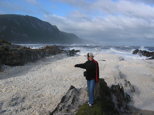
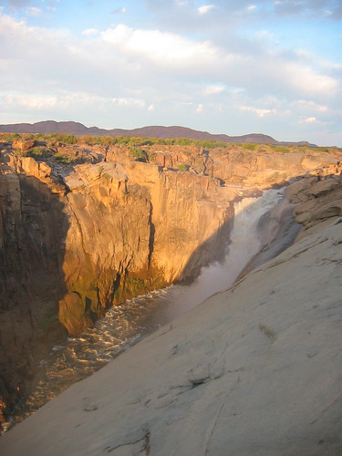
From Springbok, we headed East across dry, flat country and a very straight road until we got to Augrabies National Park. This is an arid region with the park set around a spectacular gorge. The Orange River runs through this gorge and it produces the worlds 6th largest waterfall (by what measurement we aren't sure). It was pretty dramatic to say the least, but apparently during the rainy season it flows at 30 times more volume than what you see in this photo. We did a short nature trail around the area and had a lazy day at camp, and guess what? It rained again! And we thought we were in the dry country now. Oh well, it was a hard rain, but only a short one.

Augrabie Falls:
augrabies

From the park we stopped in Upington to do some random business before saying good-bye to South Africa for a while.


So....onto Namibia.

We have learned very quickly that traveling through Namibia is going to involve much longer days in the car. The distance between sights and towns is so far! Namibia has one of the smallest populations per square kilometer in the world. We believe it.

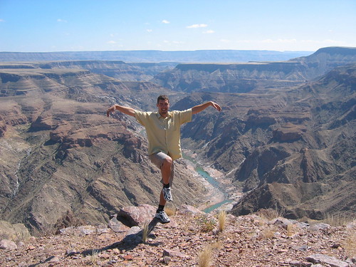
The first day we drove and drove and drove, through a sleepy border crossing, and into the Fish River Canyon region. We stayed the first night at the end of the great Fish River Canyon (which they compare to the Grand Canyon and although I haven't been to the Grand Canyon, I think the comparison is a stretch) and camped at Ais Ais, where they had a very welcome hot spring pool to help wash some of the dust off. The next day we went north to the beginning of the canyon, Hobas, which turned into a short stop as you are forbidden to do any day hiking down into the canyon. So we just stopped, admired the views and picked up a kooky Italian couple who needed a ride. The very short ride they asked for, turned into a much longer one and we had company camping that night at a very random and completely isolated spot called Naute Dam where we camped for free, and shared a lovely pasta dinner and bottle of wine.

A look into Fish River Canyon:
fish river canyon

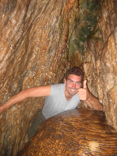
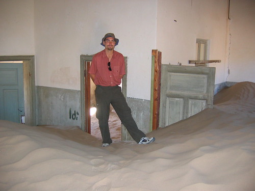
Pina and Alberto stayed with us all the way to Luderwitz which is a small fishing community on the coast. Namibia was originally settled by Germans, so a lot of the towns we will be passing through will have a bit of a German feel to them. Luderwitz is one of them and has some interesting buildings and is also close to the ghost town of Kolmanskop, a deserted German town that was built when diamonds were discoverd in the area. It has since been abandonded as there were greater diamond deposits found further south, so now it is a popular tourist destination as the sand reclaiming the buildings makes for an interesting sight.

Here is Keith in one of the many buildings. He looks like a giant!

ghost town

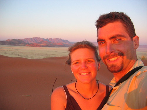
We left our Italian friends in Luderwitz, but now were sort of caravaning with another couple that we met at the backpackers in Luderwitz, Inge and Rob. We drove the backroads with them as we made our way north towards Sesrium and the great red sand dunes of Namibia one of THE tourist stops. Along the way, we found one of the most fantastic campgrounds we have stayed in yet. It was called Namtib Lodge and Camp and had a perfect desert setting - red rocks behind, open plains in front and a fabulous African sky for star gazing at night. So peaceful and so pretty. We scrambled to the top of the red rocks to watch the sunset, then had a nice evening around the campfire.

Along the scramble to the top of the rocks:
cactus

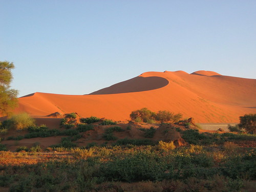
The next day we made our way into Sesrium and again shared camp with Rob and Inge. Keith and I went out to the closest dune and watched the sunset with a hoard of other tourists. The sunset wasn't all that great, but the colors it splashed on the surrounding landscape was fantastic. Sesrium sits about 65 km west of the main attraction which is Soussevlei, where the dunes are closer together, higher and more picturesque. The big thing to do, is to get up at 5:00 AM, and drive out to Dune 45 (45 km out) and watch the sunrise. We knew it would be an overrated endeavor, but what the heck. As for sunrise, they don't really open the gate in time for you to actually get to dune 45 in time to see the sunrise proper. But the early morning color you get for the hour after sunrise is definitely worth the early morning wakening. We stopped at Dune 45 (which is really only popular because it is close to the road and closer to camp than Soussevlei), took a few pictures then drove out to the end of the road. We spent the next couple hours wandering around and up and down the dunes. Really impressive and really beautiful. We took tons of pictures of course, but only a couple will make it up today.

Us on top of a dune at sunset.
dune sunset

This one was taken out in the Soussevlei area.

soussevlei

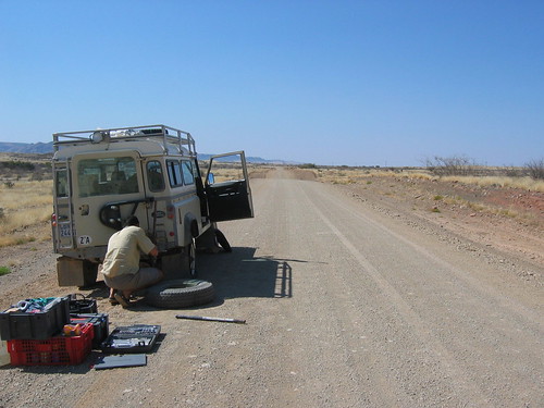
For as flat as Namibia is, there are still plenty of mountains. So we decided to go into them a little bit. From Sesrium, we headed to the Naukluft Mountains. We were only 1 km from the road into the park, when we hear a very suspicious whooshing sound out the window. Big 'ol flat tire. No problem changing it, and we finally got into camp, hot, dusty and exhausted (this hot weather driving stuff can wear a person out!). We had a lovely camp setting right on a very small river with lots of trees and pretty much just kicked back the rest of the night. To explore this area we did a 17 km day hike up a river bed, over a canyon and down another river bed. We were lucky enough to have a breezy day and as the nights are cold here, and we started early, we actually were cold for most of the hike. A very pleasant hike, and we were out in time to drive all the way into Windhoek, the capital of Namibia. Yes, back on paved roads and back into civilization.

Flat tire and a look at the typical Namibian road.
flat tire

And so here we are. Cleaning the dust off of everything, washing clothes, shopping and getting the tire repaired. We hope to set off tomorrow and will head back to the coast to a place called Swapkomund. I wish I could post more pictures for you, we have lots of really nice ones, but it's hard to find places that let me change the size of the photos, and with large photos, it makes for a slow upload. We'll try to post again soon, but don't be surprised if it doesn't happen until we are back in Pretoria!


One more thing....
CONGRATULATIONS Sarah and Wayne on your new addition! Welcome to the world Tanner!

Wednesday, August 16, 2006

Cape Town

So many people we met along the way told us how great Cape Town is, and how much we were going to love it. Especially the locals. They are so proud of this city. Us not being the big-city type of people were of course sceptical and took the advice in stride. We have spent the last three days in Cape Town and the surrounding area and can see how people fall in love with the place. The Cape point is some truly stunning, dramatic coastline and the city of Cape Town itself has a pretty amazing setting. Table Mountain looms in the background..... an awesome sight. The city reminds us of a bit of a cross between Portland and Seattle...not as big as Seattle, but has the same waterfront feel.

From Hermanus, we took the scenic route along the coast towards Cape Town. Beautiful coastline. It was a sunny Sunday, so the weekend warriors were out in hoards. We stopped in Muizenberg where we were lured in by the bustling market and fresh fish being sold on the street. It happened to be one of the more popular beaches along this False Bay route, and the parking lot was jam packed. We weren't moving anywhere, trying to find a place to park and started noticing lots of ambulances, police and even a helicoptor. We finally wormed ourselves in and asked what was going on. Answer? Shark attack! No kidding. A guy had just gotten his foot chomped off by a great white cruising in the bay. The irony of it is that the guy is a lifeguard and was out with his co-workers on a training exercise. We joined the gawkers and watched as he was loaded into the helicopter and flown away to Cape Town. Needless to say the beaches were closed for the rest of the day.

Some of the scenery we saw along the False Bay route to Cape Town:
False Bay scenery


From there we moved on south towards the point, pausing only to gaze at another whale right offshore for a while. We stopped outside of Simon's Town and walked around Boulders Beach. A beach wth lots of rounded granite boulders, bright white sand,turquoise water, and penguins. Lots of penguins! There is a huge colony of African Penguins living here that are now protected by the national parks. So we walked around and laughed at the cute creatures as they clumsily walk around.

Some of the penguins just coming in from a fishing expedition:
African Penguins!

It was late enough in the day that it wouldn't be worth the trip all the way out to the point, so we found a campground close by and set up home for the night.

Here is a look at a typical meal and typical setting around camp:
Typical night at camp

The next day, guess what? We woke up to gale force winds (not quite) and lots of rain. Not going to be able to always have perfect weather, so we headed out to the Cape Point anyway. The Point is the most south-westerly point on the continent of Africa (not the same ring as the southern most point, is it?). The whole point is a national park with an array of hiking trails, a lighthouse and lots of great views. We donned our ponchos (turned out to be a great purchase we made way back in Laos!) and did the walk from the lighthouse to the Point and then walked around the lighthouse a bit. Really stunning views, even on a cloudy, rainy day.

On the way to the Cape of Good Hope and the south-western point of Africa.
Cape Point

And the southwesterly tip.
Cape of Good Hope

We headed straight north after that and after a bit of confusion with the roads, made our way to Sea Point which is a suburb of Cape Town just south of the city center. We checked into what was for us a deluxe backpackers (a whole small apartment all to ourselves!) and relaxed. Table Mountain is probably the most famous landmark in Cape Town, if not in the whole of South Africa. So of course, we had to climb it. You can take a cable car to the top, but given the amount of really big and tasty meals we've been having, we thought it better to walk. The mountain is famous for its "tablecloth" that usually covers the top, and the table was for sure set on the day we walked up. We had mostly fog-filled views from the top, but did get some breaks, and they were spectacular. The walk up was a bit of a calf-burner on the way up and knee-killer on the way down, but fun nevertheless. After that, we walked the streets of downtown a bit and took in one museum - the District Six museum that tells the story of the once vibrant community that was "relocated" during apartheid (i.e., the neighborhood was declared "White" and all the residents were forcibly removed to outlying areas and their homes razed). So sad.

View from the top of Table Mountain - looking West:
Top of Table Mountain

Yesterday, we took the ferry out to Robbin Island and did the tour of the prison. This was the prison where the political prisoners of the apartheid era (including Nelson Mandela) were held. The tour was very much a standard tourist tour, with the exception that the tour guide was a former prisoner, having spent 20 years on Robben Island in the same cell block as Nelson Mandela. That made the tour both very informative and personal. We caught a movie after that, "Thank You for Smoking", a book we had both read, then walked back to our room. Today we head to wine counry, Stellenbosch. I will taste wines and Keith will sample the cheeses.

Saturday, August 12, 2006

Inland and Back to the Coast

We stayed two nights at a very nice, one of the best for sure, backpackers in Oudtshoorn, a small ostrich town. I say ostrich because the birds outnumber the humans 3:1. Some 80% of the world's ostrichs are there. We had ostrich egg omlette for breakfast and ostrich steaks for dinner and ostrich jerky for a snack. We took the backpackers up on one of their outings and had them drop us off at the top of Swartberg pass with mountain bikes. The morning of the ride the clouds and rain moved in, but we were committed, so off we went. We rode very quickly off the mountian, to slightly warmer and less-frequent rain.

On the way down the pass, we were treated with a very nice rainbow. Here is Em forcing a smile as she is very cold....it was beautiful despite the weather, and it was fun to be on bikes again.
Swatberg Pass


We made one stop at the local attraction of the Cango Caves. We did the caves 'adventure tour' that takes you the deepest into the cave, including several small chutes and passageways, one called the Devil's Chimney and the next the Devil's Coffin. The cave is noted for its dramatic formations, but we will spare you many pictures, as they never do the cave justice. The only ones worth showing are us squeezing through tight spaces. Here is Keith coming up through Devil's Chimney:
cango cave

It was a nice cave overall, and if you are into caves and want a better look at it, you can visit this website: http://www.cangocaves.co.za/

From Oudtshoorn, we moved on to Swellendam, revered as one of the prettiest colonial towns in South Africa. We intended to stay at Bontebok National Park but their camping was closed due to renovations. We never did make it into the park, but instead went to the Marloth Nature Reserve and did a long day hike up in the Langeberg Mountains to the top of 12 o'clock peak (Twaalfuurkop in Afrikaans). Apparently another cold front was on its way, and although we had a delightfully sunny day, it was incredibly windy up there. Seriously, it was enough to knock you off the edge if you weren't careful.

Here is Em almost on the saddle just before the last scramble up to the top:
12 oclock peak

After the hike we drove another 100km south to the southern most tip of Africa, Cape Agulhas.

On the way we went over another spectacular pass of which the name is eluding me at the moment...starts with a Th....
Thoew Pass

We camped that night in a small fishing town close by to the point called Struis Bay, and huddled up in the local pub as the cold front continued to move its way in with more gale force winds. We woke to sunny skies the next day (although still quite windy) and spent a few hours walking around the southern tip and exploring the lighthouse. Agulhas means 'needle', and sailors gave the point this name because they discovered that their compasses pointed directly north here.

Here is Keith where the two oceans meet. To be any further south and still be on land, you'd have to move on to Antarctica!
Cape Agulhas

The view from the lighthouse:
cape agulhas lighthouse view

From there we officially hit the west coast of South Africa and started moving back north towards Cape Town. We drove on as the weather progressively got worse, finally arriving in Hermanus. Hermanus is famous for its whales. The southern right whales come here in the winter seeking warmer waters for calving and raising their young. Hermanus Bay is a particularly good place to watch whales as there are high rock outcroppings that look right out over the bay and the bay is deep, so the whales can come quite close to the shore. We looked a bit for them yesterday, but the weather was too bad to stay out for long. We huddled up in the backpackers for the rest of the day as we got a mini-repeat of the storm that visited us in Tsitsikamma.

Today we woke to much clearer skies and calmer wind, so we spent the morning walking up and down the coast and saw quite a few magnificent whales. They were quite close in and while they didn't do any dramatic breeching for us, they exposed themselves enough on the surface for us to get a good idea at how massive they are. Such a neat animal...I've always said that I'd like to come back in my next life as either a dolphin or a whale....seems like a nice, peaceful, fun life.

Tomorrow it's off to the much anticipated and much talked about Cape Town!

Monday, August 07, 2006

Weathering Out The Storm

The Garden Route is the famous stretch of scenic coastline in South Africa that runs from west of Jeffrey's Bay to Mossel Bay. We spent a good week there, and got hit with one of the worst storms this area has seen in years. It rained for a good four days straight, one of those days it was a torrential downpour the whole day. We spent most of that storm at Tsitsikamma National Park, which is a fabulous park set right on the coast. We camped the first night,then after learning about the half-off all accommodation in the Garden Route national parks for the month of August we quickly moved to a chalet. (OK, the loads of rain falling on our wimpy tarp also helped in moving us to the chalet, but we were thrilled at the half-off deal!) We spent a good three days in that chalet. The first day we had some decent weather, the second day it never stopped raining, so we hung out inside mostly except for one very wet walk, and the third day there were a few hours of no rain, so we did a short walk along a coastal trail. We were happy to have been at the coast for this storm as we thoroughly enjoyed watching the waves, which were massive.

A look at the main camping area of Tsitsikamma National Park. Beautiful, eh? Even on a cloudy day.
tsitsikamma NP

This sort of gives you an idea of how the waves were for the storm. The winds were kickin' this day but the heavy rains were still one day away.
big waves

After our rainy day walk. Like our ponchos?
rain storm

The storm kicked up copius amounts of this sea foam. On the short hike we did, for a short stretch we were literally up to our hips in the stuff. It stinks and is quite dirty, but it was good fun anyway. Sadly, no photos of us running from the waves of the stuff or wading through it as we left the camera back at the ranch.
sea foam


Next stop on the way to the Wilderness National Park was our long-feared stop at the Bloukrans River Bridge. I believe the bridge is touted as the highest in Africa and someone decided that it would be a good place to jump off from! Bungy Jump that is. Emily and I had read about the Highest Bungy Jump in the World in several of our trusty guide books as far back as Tanzania. We never really thought about what it would be like to stand on the platform when we got there.

Deciding whether to jump or not was easy. For Em and I, you can’t fly to Africa and not do it. Actually jumping was a bit harder. It is a good thing that the people running it basically push you off if you don’t go on their countdown from 5 … 4….3 ….2 …. 1…. AHHHHHHHHHHHHHHH. It is an amazing experience and adrenaline rush. And just so ya know, we both jumped on our own, no push needed, thanks.

The whole experience, including everything such as gear, procedures, etc, was first class and they are very proud of their safety record. It would be a bit hard on their advertising to if they had to say. ”Well there was this one guy, we forgot to…”
Em told me as she after she finished that she “….ran out of scream”. Mouth was open and the desire to scream was there, but no scream! Emily’s scream ran out.


Bungee Jump Photos....there's lots. And lots more, plus a video for you all to watch when we get home!
Keith getting strapped up. You sure this is going to hold?
are u sure

Keith safely back on solid ground. Emily wondering how it went. One very happy, the other very nervous...
how was it

Again, one happy, one nervous. Emily wore this same nervous smile until she got pushed..errr until she jumped.. off the bridge...
one down one to go

The Push. These guys don't give you an option. It's 5, 4, 3, 2, 1, Bungee....and you jump as they push you off the bridge!
the push

There is no turning back now...
no return
Falling.....
falling

Still falling...that was a LONG 7 seconds.
still falling

And finally, returned to safety. And smiling.
back to safety

That is a lonnnnggg way down. But we did it!
far down

We then pushed on to Nature’s Valley for one night, then on to Wilderness for two. We stayed in cabins all three nights and the weather cleared to beautiful clear skies by the time we left Nature’s Valley. We hired a canoe at Wilderness and paddled and hiked to a nice waterfall. That is about it for activities. We ate great dinners as we are still quite enjoying cooking for ourselves. Actually it’s the eating of the dinners we like, but the cooking is OK too.

We have now moved inland to the Route 62 and will take this east towards Cape Town. The scenery here is in stark contrast to the Garden Route. We are in what I’ll call high desert, with green valleys, dry plain, all surrounded by mountains.

A brief lunch stop at the Knysna Heads, on the way to Wilderness.
knysna heads


On the way up the Montuga Pass, heading inland.
montuga pass