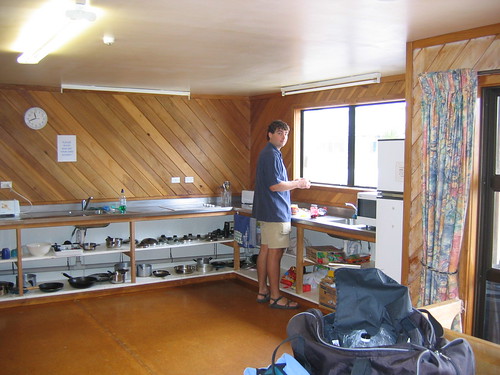
Let's see....it's been a couple days, but we really only did one thing of significance. The Tongariro Crossing in the Tongariro National forest. The day getting to the National Park Village, was a relaxing one. We took the Kiwi Experience to the "village", getting there by 1:00 and spent the rest of the day just reading books, relaxing, playing volleyball, cards, and chatting with other travelers. Here is a shot of the kitchen at this particular hostel. This was a smaller hostel, but quite nice. Our room was much bigger this time, and we even had our own private bath. The town/village of National Park is more of a ski town, so it is pretty sleepy this time of year. Most coming through are here to do the crossing, then are gone. The hostel is cozy and has a very ski lodge sort of feel to it. Here's a look at the inside cooking area:
So the next day we awoke early to take another $25 shuttle to the hike. This is a very popular hike, and I was a fool to think that being early spring there wouldn't be that many people on it. The funny thing is, is that everyone gets there via shuttle because it's a one-way hike (not out and back, or a loop), so you have to shuttle in some way, and its easier even for those with cars to take advantage of the throngs of companies who provide the service. So all the buses show up to the trailhead within an hour of each other, and starting the hike, being the competitive people we are, it feels a bit of a race in the beginning. You know, 'don't let them pass us', 'we can't get stuck behind that group again!'. Until you remind yourself, it doesn't matter if that 80 year old just passed me, I'm here for the scenery. huff puff. "Soooo yeah." (E. Izzard). It was a bit of a freeway on the trail. But well worth it.
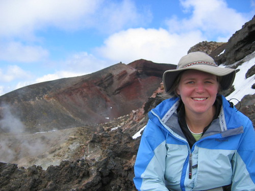
There are three major mountains around this crossing: Mt Tongariro, Mt Ngaruhoe and Mt Whakapapa. This crossing takes you in between Mt T and Mt N, and then wraps itself around the north side of Mt Tongariro. The total length is 17 km, and in our direction translates to signage that says 7-8 hours. It's all volcanic, and the first half was strikingly so. It had a very desolate, bleak feel to it, yet pretty at the same time. Not a lot of plant life, very dark, lots of craters and lava flows. There was a very hard climb early in the hike, but it got all the elevation gain out of the way at once, and when we reached the highest point, we were rewarded with views of the Emerald Lakes, more craters and steaming rocks that I was able to use to warm my Reynaud's stricken hands on.
Here's a shot of Red Crater:
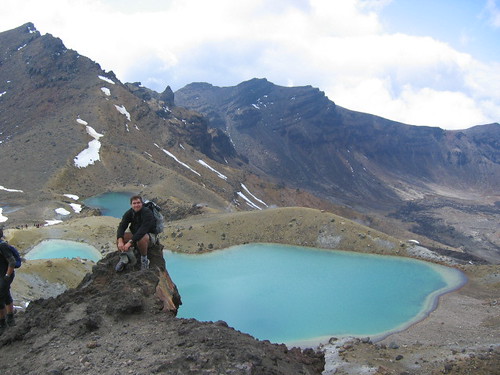
And here's a look at the Emerald Lakes:
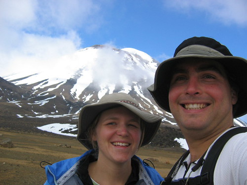
From there as we wound around the mountain and started heading down, we were rewarded with what felt like changing temerate zones. We started in the bleak volcanic wasteland, then entered grassy highlands, then eventually into lush forest. The weather cooperated for the most part. It was cloudy most of the day so views of the mountain tops were limited. We did get one or two clearings while on the higher regions and managed to catch it in a photo. This is Mt Ngaruhoe, the same mountain as seen from far away in the beginning of this entry:
We enjoyed another pleasant evening at the hostel that night, got up this morning had a leisurely breakfast, went on a two hour walk on a local trail, then caught our Kiwi Express transport to Wellington, which is where I sit now typing this blog. Our hostel here is HUGE. With similar amenities but on a larger scale. It's located very centrally, so seeing the highlights of the city tomorrow will be easy. Then we're off to the much anticipated south island, where the hiking will begin in earnest.
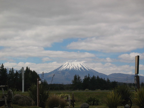
So, the mountain above. Did you figure it out. The title to the blog was a hint. It's Mt Doom from LOTR (Lord of the Rings). So we have officially (although accidently) been on part of the LOTR tour. (We've also seen plent of Hobbitons, although not the offical one - everywhere is Hobbiton in this country!).
All right enough for now. We've noticed the emails and comments have been dropping off....is anyone reading these? Ah well, at least we'll have a good record for ourselves.
Cheers.
Paul - yes, there are lots of "dippable" hot springs. We had one at the hostel we stayed in (formed by concrete, but it was the natural water). And there are lots others you can walk into, but without having a car, they are hard to go explore. I imagine there everywhere around here, and you frequently see steaming hillsides.
3 comments:
I love your website. Keep it up.
Mom Bauer
Kind of hard to follow exactly where you are. It would be nice when you talk about a place to match it up with something on your location map.
You are most diligent about keeping us informed. Too much volcanic activity, though. That was a nice "shred" of limestone in one picture, but there were two big heads blocking the view of much of it.
Paul and I found a nice limestone cave about TWO MILES form his house. I couldn't get very far in because it was very slippery and steep. Paul had to haul me out with a rope. Paul and Matt will have to check it out for me.
Keep posting pictures.
Hey guys. I didn't realize you would be posting so much. Jeez you have already done so much... sailing, mountain climbing and frolicking with Hobbits. And to think you only have what, more than a year of all this travel left! You are going to need to publish a coffee table book on your travels when you get back.
Stay Safe.
Post a Comment