We checked into another lovely hostel, and got some invaluable information about the trail from the Info center and worked out our transportation for the next few days. We stumbled upon another great deal and were able to get a free rental car for our transport back out of Motueka (after the hike) and to Picton where we were meeting John and Jenn. A pathetic car, really - like a Geo, but free is free (someone ditched a rental in Motueka and the company needed someone to drive it back to Picton).
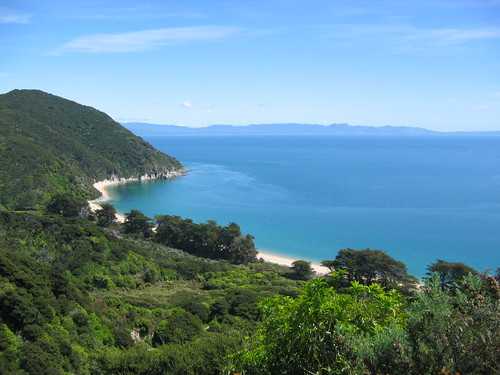
That was a bunch of nonsense really, I suppose the hike was more interesting than all of that jibber jabber. Adn a lovely hike it was. 51 km total, hiked over 3 days, 2 nights. The weather was great. Sunny and hot the first day, cloudy and cool the second, and somewhere in between on the third. It never did rain however. As the name implies it is a Coastal track, so it follows the coastline af the Abel Tasman National Park which sits on the East side of the northern most peninsula of the north island. The best way I can describe the scenery and climate is to say it is a combination of Hawaii and the Pacific Northwest. The scenery looks like Hawaii - white sand pristine beaches and bright blue water, surrounded by subtropical forests; but the temperature of the water and surrounding air is much like that of the NW. Not a bad combo if I do say so myself. I think when the warmer waters arrive in the summer, they become much more swimmable beaches. So as you start the track (which we did from north to south), you see these beautiful beaches, and of course we take pictures of them all and try to walk on as many of them as we can, but then towards the end of day 2, you start to take the beaches for granted and don't worry too much about missing one or two of them.
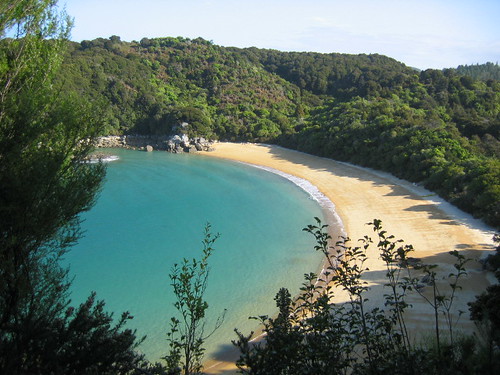
Here's a look at one of the beaches from afar:
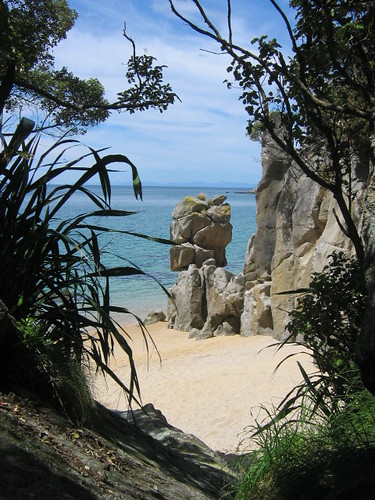
Here is another look at a beach and an interesting granite rock structure. Granite predominates throughout the park.
The other interesting part of this track was the tidal crossings. You had to plan your hike and your campsites based on the tides, because there are two or three estuary crosssings that can only be crossed within 2-3 hours of the low tide. The tidal swings in this area are huge. 3 meter tidal changes. Making some at high tide impassible, or requiring a very long high tide walk-around route, potentially adding hours to your day. Here is a shot of Keith crossing the first big one, and the only one that didn't have a high tide route, so you had to time this one right. This ended up being the end of our first day, and you can see the hut ahead of Keith. We didn't stay in the huts, but usually camped very close to them.
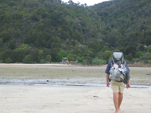
What was really fascinating at this camp in particular was watching the time come back in. All of where Keith is standing in that picture eventually became a huge river. We could literally see the tide come in. We'd stand about 3 feet from the water's edge, and within 30 seconds the water would be at our feet. And the bubbling sounds coming from all the clam holes was unreal (the sand we walked on here was littered with steamer clam shells). We should have shot a video of it.
Don't know what else to say about the hike. Pretty nice the whole way. Lots of ups and downs like any coastal hike will be and lots of walks along the beaches as that is where the trail runs. New Zealander's have the tramping thing down. The trails are in excellent condition and the campsites and hut sites are very well equipped with flush toilets at most and filtered water at quite a few. Of course this is one of the most popular hikes so it also heavily regulated - we got checked for our permits each night.
We also learned what we already knew and that is that it has been a LONG time since we have done an overnight hike. We felt it the first day. Either that or we are just getting old. A combo of the two I am sure.
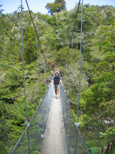
Here is a shot of the suspension bridge we crossed on the second day:
And a look at the beach where we camped the second night. Pretty nice, eh?
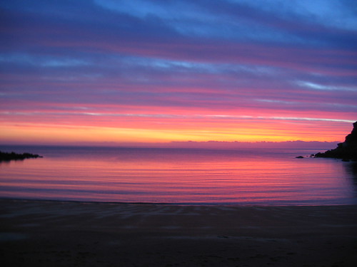
Here's a sunrise I stumbled upon when I got up for an early morning trip to the "loo".
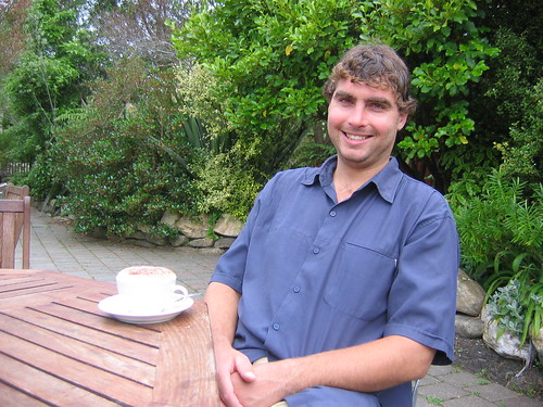
And finally at the trails end, waiting for the bus, trying to recover with the infamous cappucino.
No comments:
Post a Comment